|
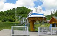
Duration 9 hours
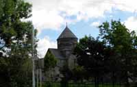
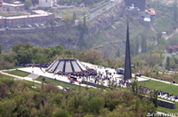
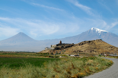
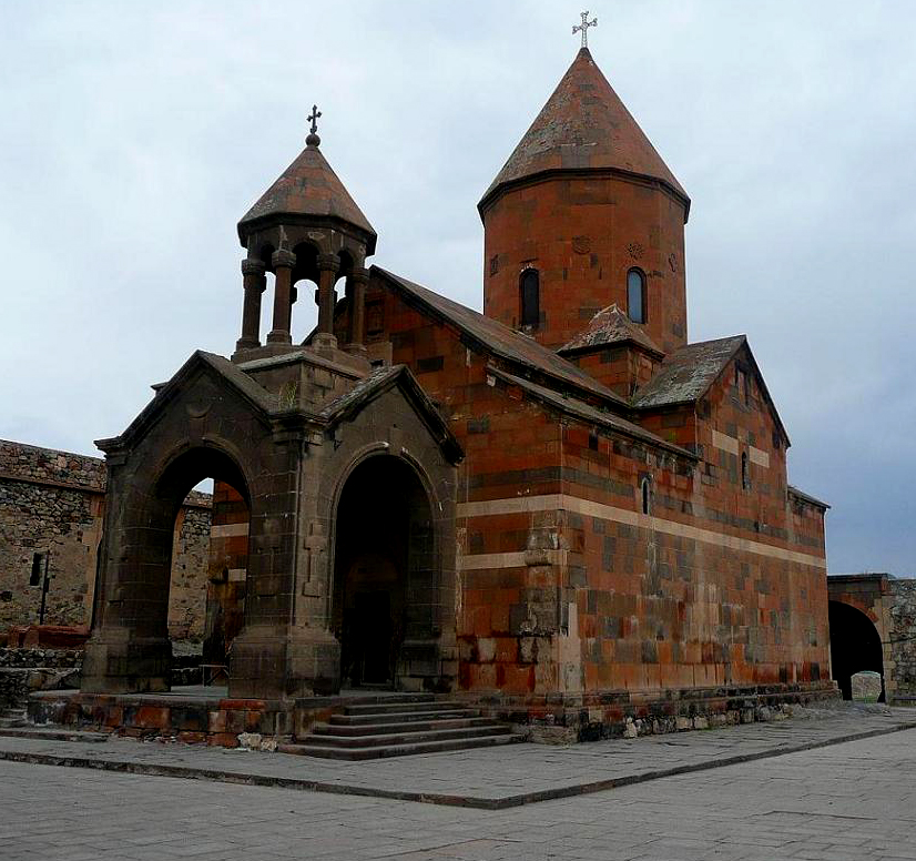
First Stop.
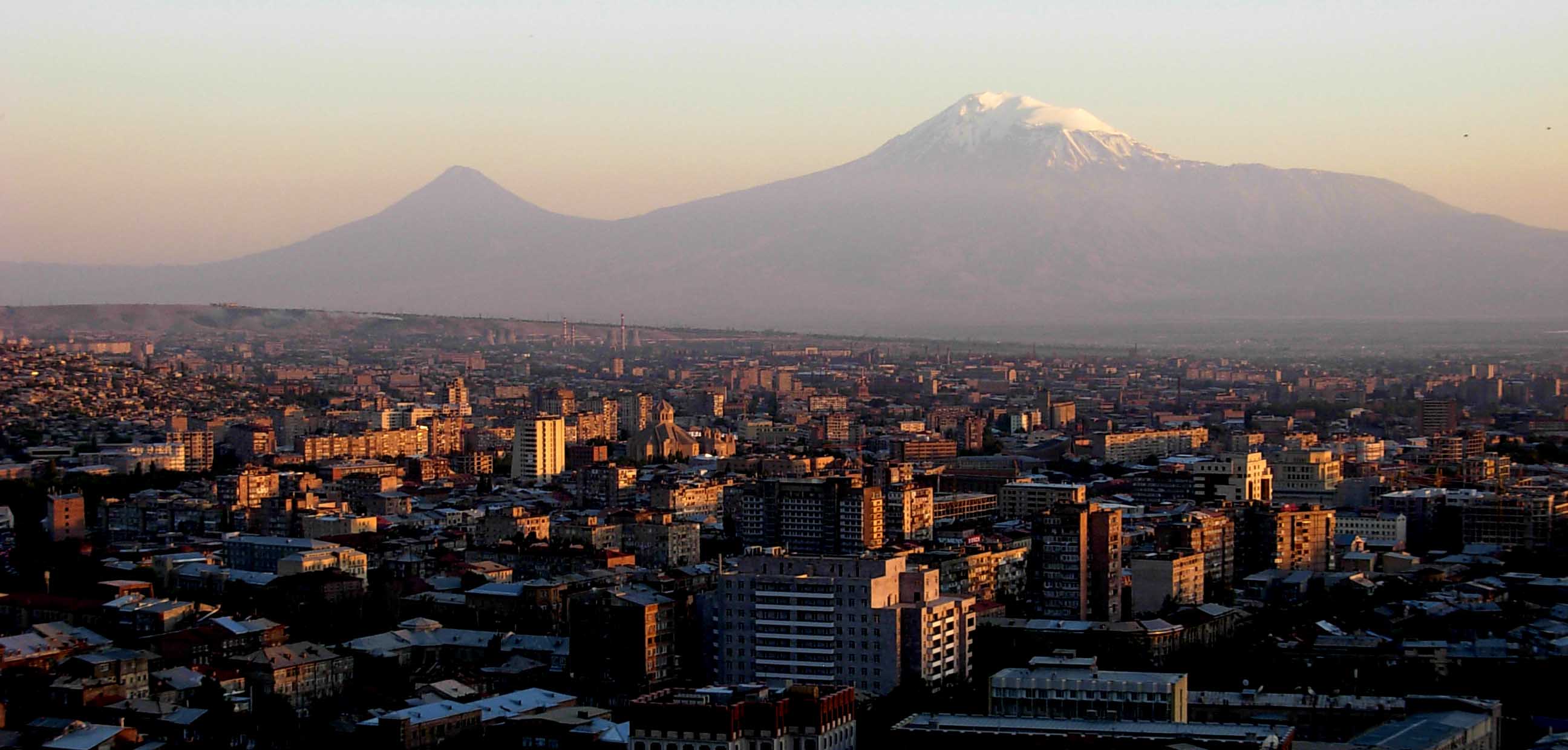
Khor Virap Monastery with Mt.
Ararat behind it.
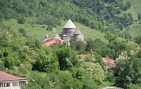
Khor Virap is one of the most popular destinations
in Armenia for a number of reasons, primarily because it
is where Grigor Luisavorich (St. Gregory the Illuminator)
was imprisoned for 13 years before curing King Trdat III
of a disease. This caused the conversion of the king and
Armenia into the first officially Christian nation in the
world in 301AD. To this day, you can visit the underground
chamber he was imprisoned, located in the nondescript St.
Gevorg Chapel apart from the main church.
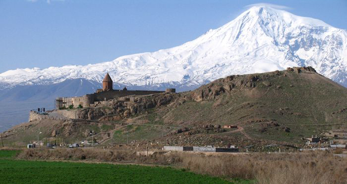
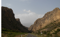
The monastery rests atop a little hill in
an otherwise very flat Ararat Valley. When you arrive you
will be as close to Mt. Ararat as you can probably get in
Armenia. It is huge and towers over Khor Virap on even
hazy days.
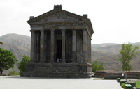
The large St. Astvatsatsin church at Khor Virap was built
in the 17th century and is typical in design, but with a
lack of virtually any decorative carving, or elements. It
is located in a fort like complex with a nice courtyard.
The hill of Khor Virap and those adjoining were the site
of the important early Armenian capital of ancient
Artashat, built by Armenian King Artashes I, founder of
the Artashesid dynasty, around 180 BC. According to
legend, the Carthaginian general Hannibal, who spent his
twilight years in flight from a vengeful Rome, inspired
the founding of the city. There are extensive excavations
of residential and other structures. Ancient coins and
potsherds can still be found. The site was destroyed by
the Persian King Shapur II, and the capital was moved to
Dvin by King Khosrov III (330-338). The course of the
rivers has evidently changed, since ancient authors said
that this spacious and well-laid-out city was located at
the confluence of the Araxes and Metsamor rivers.
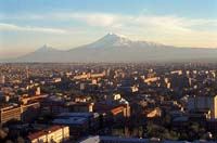
Mt. Ararat (5,165 m) is a
stratovolcano, formed of lava flows and pyroclastic ejecta,
with no volcanic crater. Above the height of 4,200 m the
mountain mostly consists of igneous rocks covered by an
ice sheet. A smaller 3,896 m cone, Little Ararat, rises
from the same base, southeast of the main peak. It is not
known when the last eruption of Ararat occurred; there are
no historic or recent observations of large-scale activity
recorded. The Ararat anomaly is an object appearing on
photographs of the snowfields near the summit of Mount
Ararat and is advanced by Christian believers as the
remains of Noah's Ark.
Over the centuries, the area of Ararat has been contested
territory between several states. The first unified state
to rule the region surrounding the mountain was ancient
Urartu.
After the decline of Urartu following
invasions by Scythians and the Medes in 585 BC, a
semi-independent Armenian state emerged under the rule of
the Orontid Dynasty. After the defeat of the Achaemenids
by Alexander the Great in 330 BC, the Orontids gained
autonomy, albeit under Macedonian influence. Antiochus the
Great briefly subjugated Armenia in 201 BC, ending Orontid
rule in the region. After the defeat of Antiochus in the
Battle of Magnesia, a new independent Armenian Kingdom
emerged in 198 BC that lasted for over six centuries,
until 428 A.D., when it was briefly being annexed to the
Roman Empire by Trajan from 114 to 118. Following the
partition of Armenia between the Roman Empire and Sassanid
Persia in 428, the region was a constant battleground
between the two, and afterwards between the Arab Caliphate
and the Byzantine Empire.
Ararat became part of the territory of the Armenian
Kingdom under the Bagratuni Dynasty early in the ninth
century AD, which was then annexed by Byzantium in 1045.
It then lost the territory to the Seljuk Turks following
the Battle of Manzikert in 1071. The Georgian Kingdom took
the region from the Seljuks from the late 12th century to
the early 13th century, until various Mongol rulers of the
Ilkhanate, including Tamerlane, took control of the area
in the 13th and 14th centuries. The region was conquered
by the Ottoman Empire in 1517 and often fought over and
taken by the Safavids. In 1855 the northern side of the
mountain became part of the Russian Empire, the southern
side remained within the Ottoman Empire.
Dr. Friedrich Parrot from Dorpat University, with the help
of Khachatur Abovyan, was the first explorer in modern
times (1856) to reach the summit of Mount Ararat.
In 1918, in the aftermath of World War I, the fall of the
Ottoman Empire and the October Revolution, the area became
part of the Democratic Republic of Armenia, but the
Republic was short-lived. With the invasion of the Red
Army, the area became part of the Soviet Union. Following
the Treaty of Kars in 1921, the area was divided up
between Turkey and the USSR, and the new border, which
became internationally recognized, placed Ararat on the
Turkish side of the border.
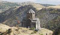
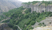
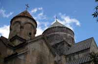
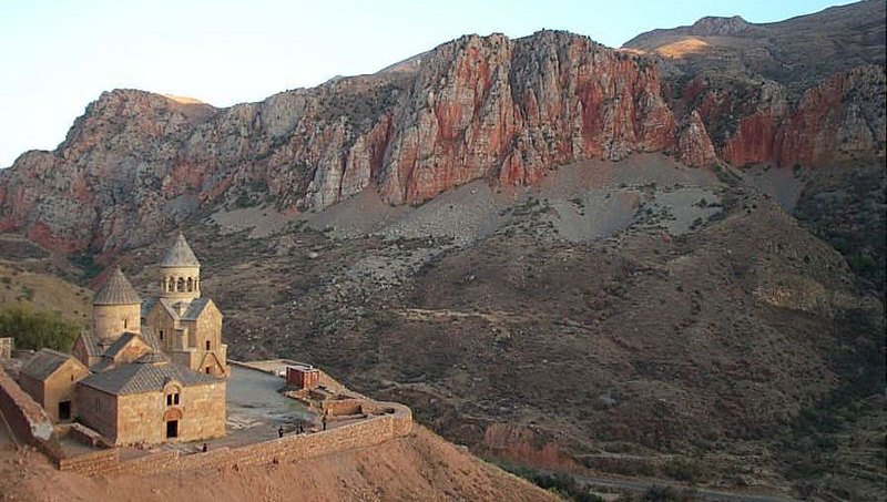
Second Stop.
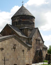
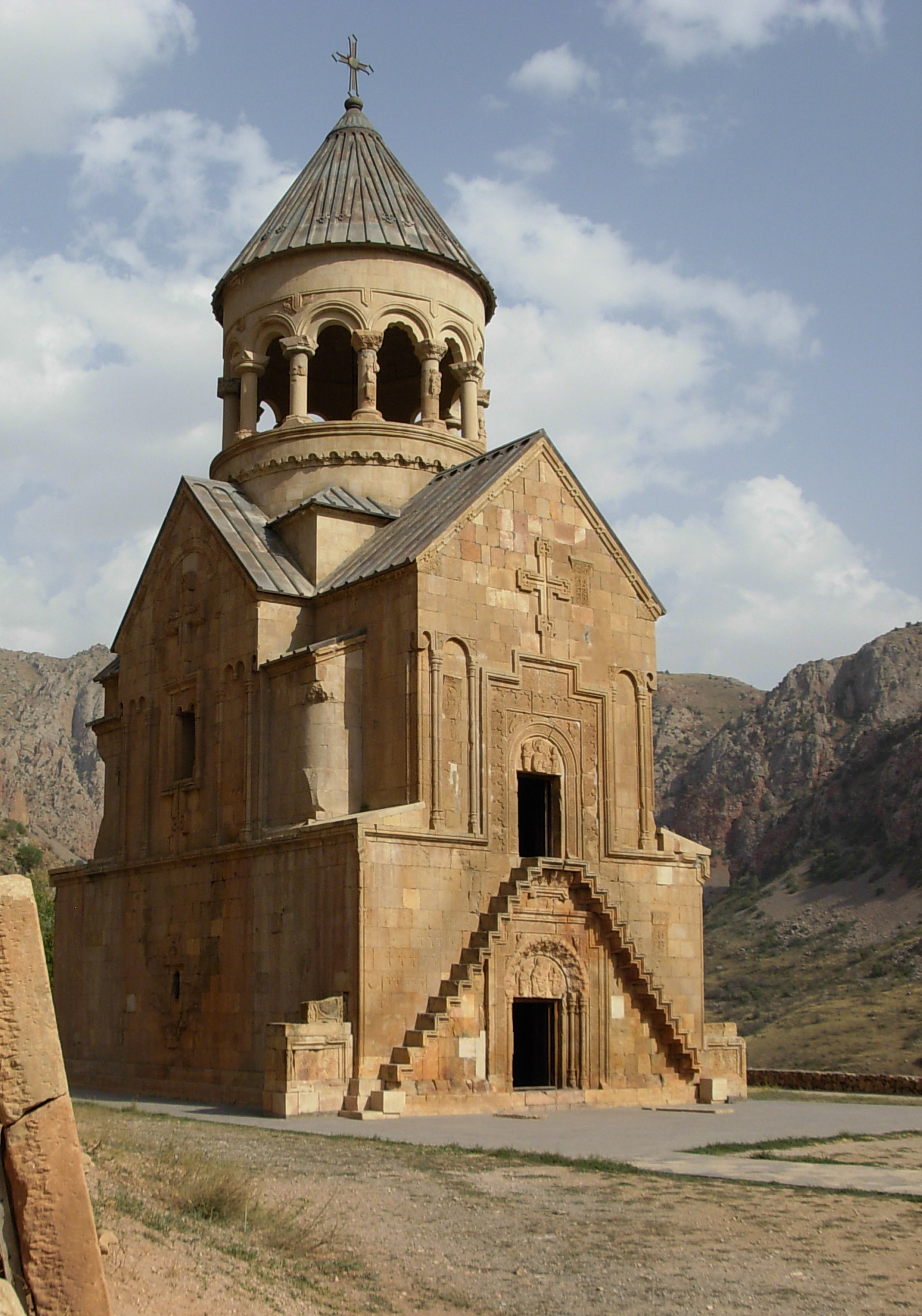
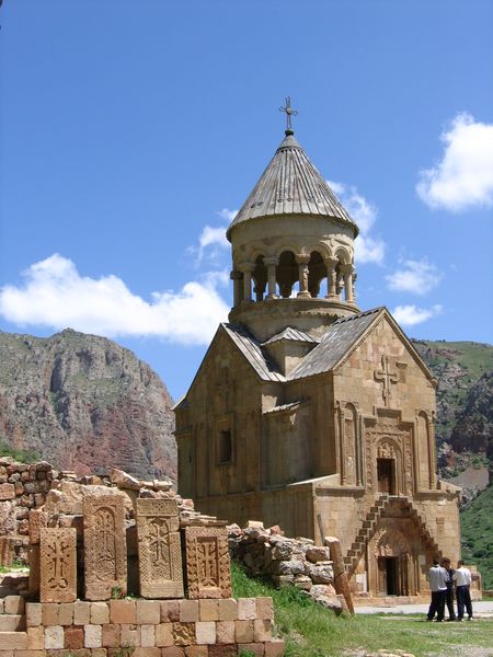
Noravank
Noravank (Նորավանք, meaning New Monastery) is a 13th
century monastery, located 165 km from Tsakhadzor in a
narrow gorge made by the Darichay River. The gorge is
known for its tall, sheer, brick-red cliffs, directly
across from the monastery. The monastery is best known for
its two-storey S. Astvatsatsin church, which grants access
to the second floor by way of narrow stones jutting out
from the face of building. In the 13th-14th centuries the
monastery became a major religious and, later, cultural
center of Armenia.
 Noravank
was founded in 1205 by Bishop Hovhannes. The monastic
complex includes the church of S. Karapet, S. Grigor
chapel with a vaulted hall, and the church of S.
Astvatsatsin (Holy Mother of God). Ruins of various civil
buildings are found both inside and outside of the
compound walls. Noravank was the residence of the Orbelian
dynasty. The architect Siranes and miniature painter and
sculptor Momik worked here in the latter part of the
thirteenth and early fourteenth century. The fortress
walls surrounding the complex were built in the 17th-18th
centuries. Noravank
was founded in 1205 by Bishop Hovhannes. The monastic
complex includes the church of S. Karapet, S. Grigor
chapel with a vaulted hall, and the church of S.
Astvatsatsin (Holy Mother of God). Ruins of various civil
buildings are found both inside and outside of the
compound walls. Noravank was the residence of the Orbelian
dynasty. The architect Siranes and miniature painter and
sculptor Momik worked here in the latter part of the
thirteenth and early fourteenth century. The fortress
walls surrounding the complex were built in the 17th-18th
centuries.
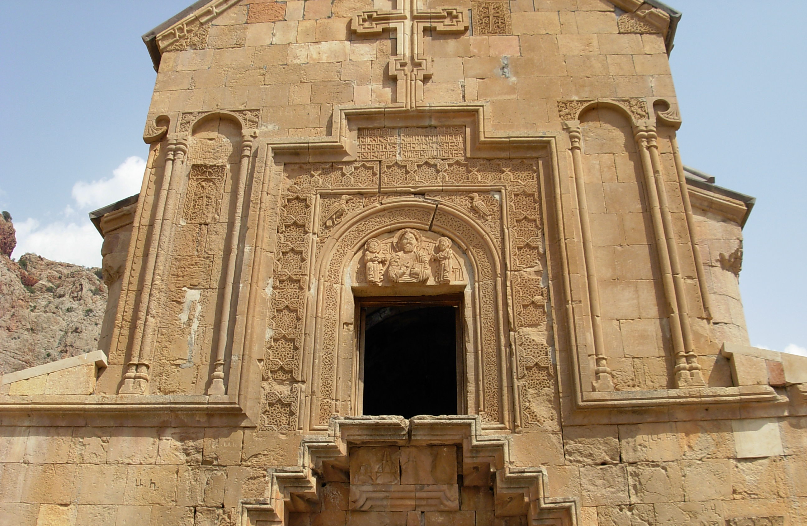
The grandest church is the Astvatsatsin also called
Burtelashen ("Burtel-built") in honor of nobleman Burtel
Orbelian, its financer. The church, completed in 1339, is
said to be the masterpiece of the talented sculptor and
miniaturist Momik. The ground floor contained elaborate
tombs of Burtel and his family. Narrow steps projecting
from the west facade lead up to the entrance to the
church/oratory. Note the fine relief sculpture over the
doors, Christ flanked by Peter and Paul.
Burtelashen is a highly artistic monument reminiscent of
the tower-like burial structures of the first years of
Christianity in Armenia. It is a memorial church. Its
ground floor, rectangular in the plan, was a family burial
vault, and the first floor cross-shaped in the plan, was a
memorial temple a multi-column rotunda.
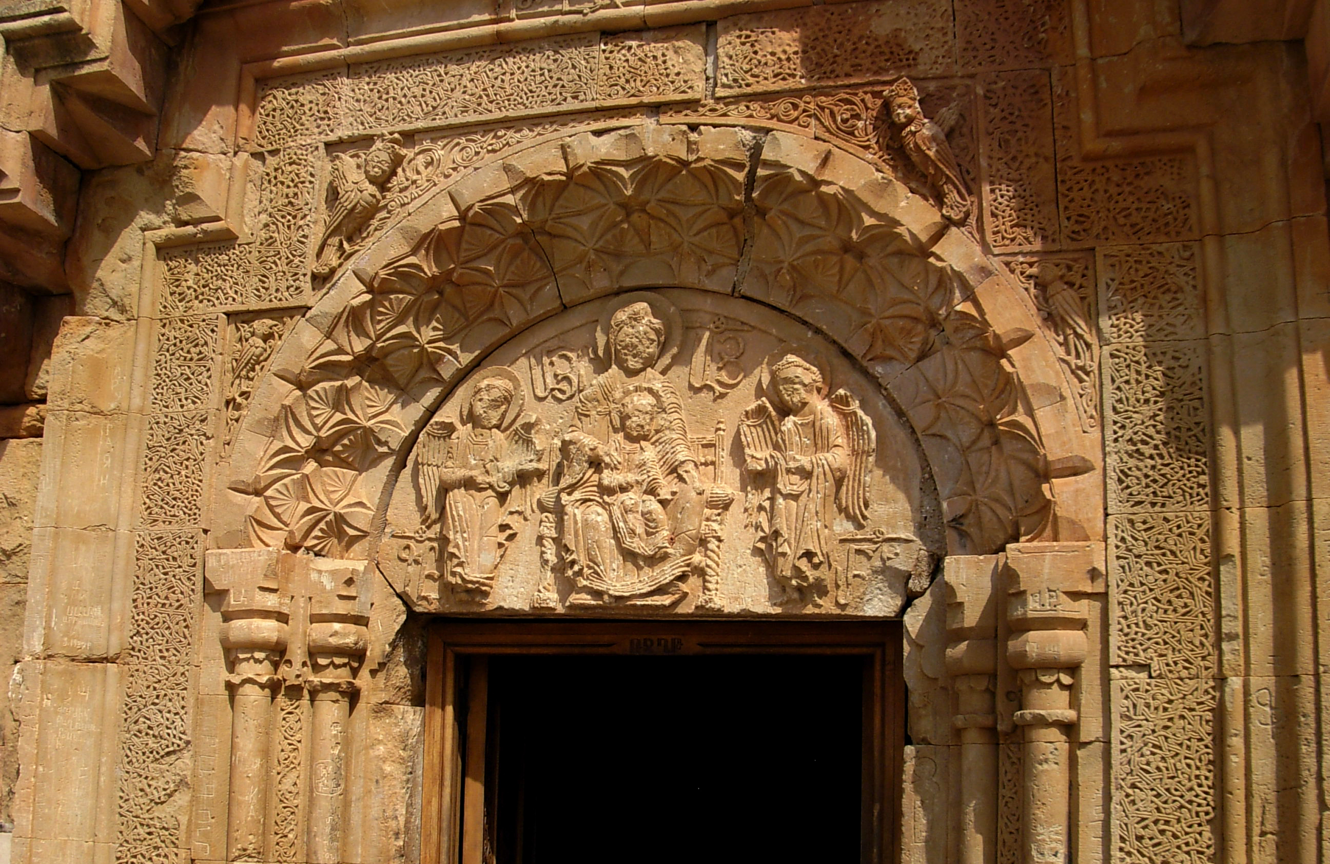

The second church is the S. Karapet, a
cross within square design with restored drum and dome
built in 1216-1227, just north of the ruins of the
original S. Karapet, destroyed in an earthquake. The
church was built by the decree of Liparit Orbelian. The
pointed tympanum of the twin window over the door is
decorated with a unique relief representation of the
large-headed and bearded God the Father with large almond
shaped eyes blessing the Crucifix with his right hand and
holding in his left hand the head of Adam, with a dove -
the Holy Spirit - above it. In the right corner of the
tympanum there is a seraph dove; the space between it and
the figure of the Father is filled with an inscription.
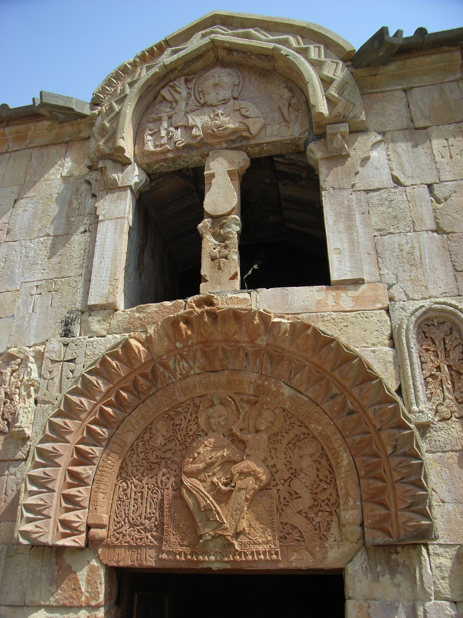
The side chapel of S. Grigor was added by the architect
Siranes to the northern wall of S. Karapet church in 1275.
The chapel contains more Orbelian family tombs. The modest
structure has a rectangular plan, with a semi-circular
altar and a vaulted ceiling on a wall arch. The entrance
with an arched tympanum is decorated with columns, and the
altar apse is flanked with khachkars and representations
of doves in relief.
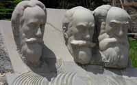
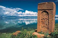
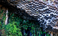
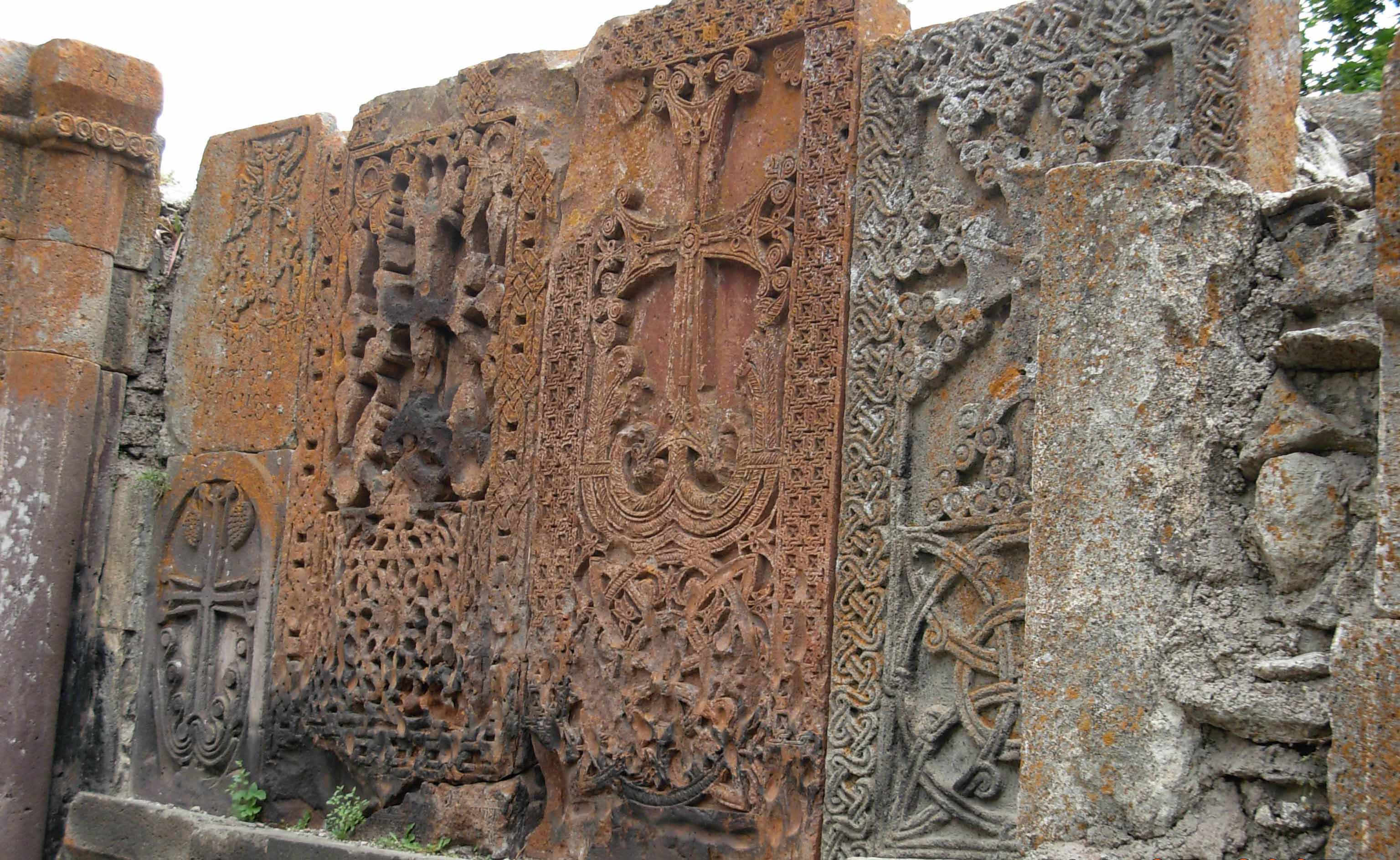
The complex has several surviving khachkars.
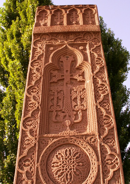 Khachkar
(cross-stone) is an outdoor, vertically erected flat
stele, which, when in situ, is positioned in relation to
the four cardinal points of the world; the western side
has an ornamentally carved cross, accompanied by
vegetative-geometric motifs, with animals (particularly
birds), and sometimes with carvings of people. The
khachkar both stimulated and reflects the unique
development of Armenian culture; it is one of the most
characteristic symbols of Armenian identity. With its
marvelous carvings, savior symbolism of the cross, and the
notion of eternity, which is conveyed by the stele, the
khachkar was one of the most respected and, due to its
positioning under the open air, one of the most accessible
saints. After more than a thousand years, the khachkar is
also a contemporary cultural phenomenon; today hundreds of
khachkars are still being created in Armenia. Khachkar
(cross-stone) is an outdoor, vertically erected flat
stele, which, when in situ, is positioned in relation to
the four cardinal points of the world; the western side
has an ornamentally carved cross, accompanied by
vegetative-geometric motifs, with animals (particularly
birds), and sometimes with carvings of people. The
khachkar both stimulated and reflects the unique
development of Armenian culture; it is one of the most
characteristic symbols of Armenian identity. With its
marvelous carvings, savior symbolism of the cross, and the
notion of eternity, which is conveyed by the stele, the
khachkar was one of the most respected and, due to its
positioning under the open air, one of the most accessible
saints. After more than a thousand years, the khachkar is
also a contemporary cultural phenomenon; today hundreds of
khachkars are still being created in Armenia.
|